
WE APOLOGIZE
Due to the circumstances of Covid-19 pandemic, we have to postpone the expedition until further announcement. Stay healthy wherever you are.
Overview
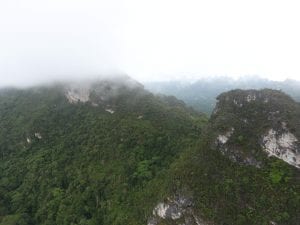
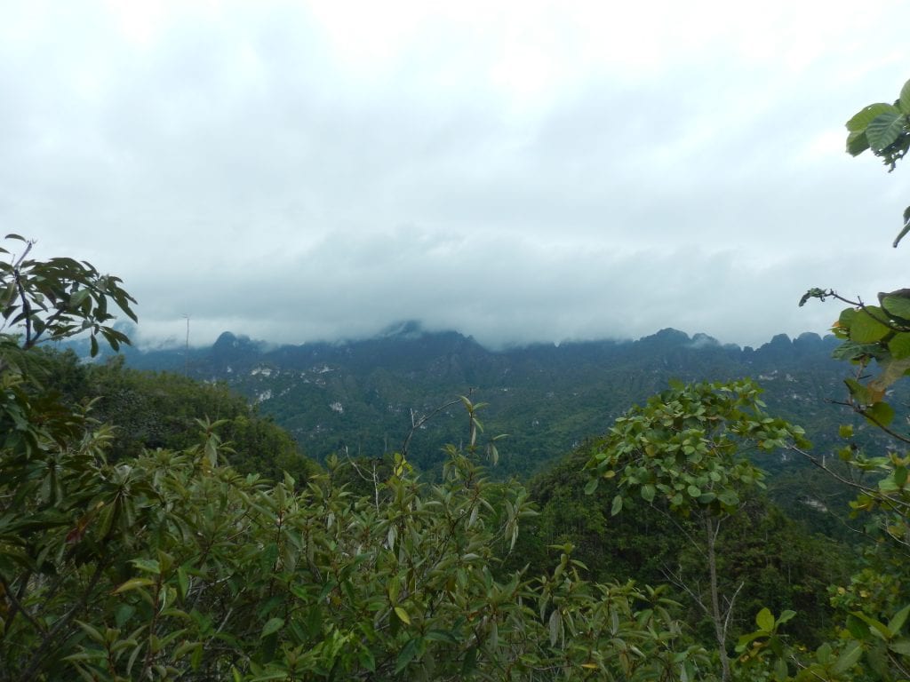
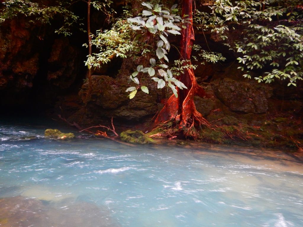
Located in eastern part of famous Borneo Island, Sangkulirang-Mangkalihat is a hidden gem covered by dense and pristine rainforest. Although several explorations have been done and discover many breathtaking features, most of the part is still remain unknown. It is filled with soaring karst-tower, crystal-clear spring, and gigantic caves, making this region incomparable with others.
Sangkulirang-Mangkalihat karst is divided into several blocks each contains its own chalenges. Further and deeper explorations are still needed to add more values to this area. Uniquenesses of this area can be seen from its geological, speleological, and even archaeological phenomenon. This is home of the many rock art caves, revealing how our ancestors lived and culture. Through all of those features, it is very urgent to establish the status as Geopark or World Heritage in order to preserve the richness of this area.
This expedition is initiated by Karst Research Group of Universitas Gadjah Mada and one of the parts of Road to International Karst and Cave Year 2021 under patronage of Asian Union of Speleology and Federation of Indonesian Sepelological Activities. International Union of Speleology and Eurospeleo are also invited to join this event.
Objectives
Main Objective of this exploration is to increase and discover the value of this karst through:
- Finding and exploring new caves
- Study the karst hidrology
- Geological mapping
- Speleogenesis
- Biospeleology
- Archaeology investigation
- Tourism planning
Location
Speleonesia Expedition: Sangkulirang-Mangkalihat Chapter will be focused to two main locations: Tondayan Block and Mangkajang Block.
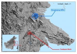
Tondayan Blocks
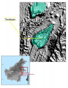
A bowl-shaped Tondayan Block is arguably the most fascinating and unique block in Sangkulirang-Mangkalihat Peninsula. It is located 200 kilometers straight north from Samarinda, capital city of East Kalimatan Province and 100 kilometers south of Tanjung Redeb, capital city of Berau Regency. This block is situated in the central part of Sangkulirang-Mangkalihat karst system and the most remote block.
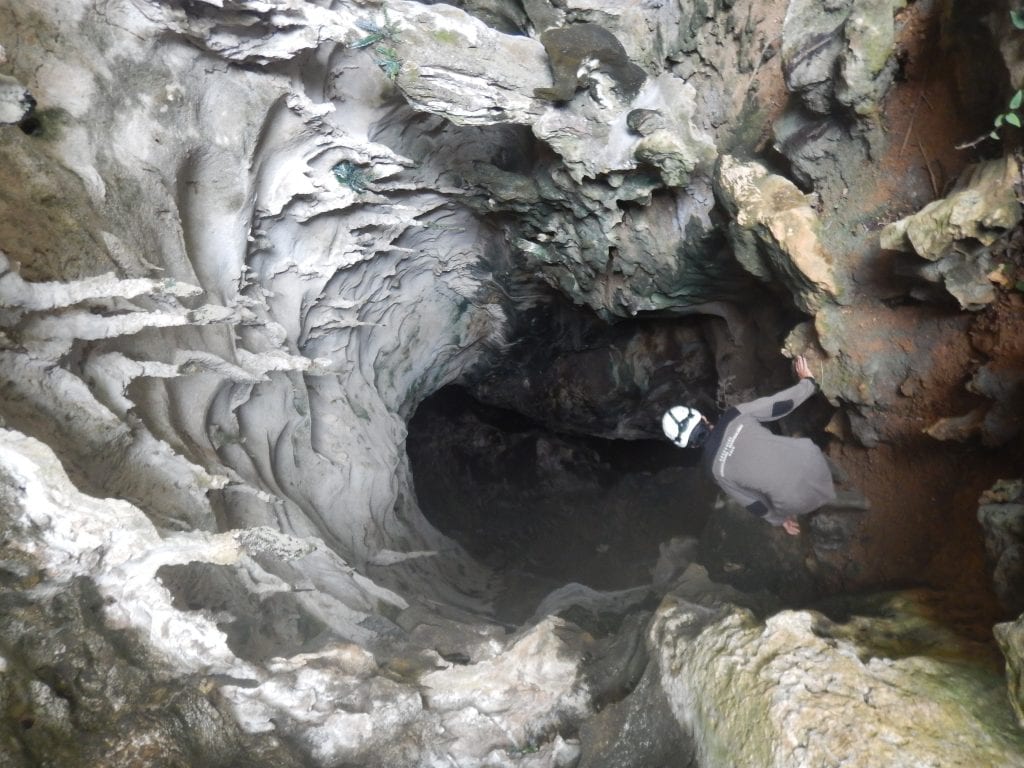
This block is bounded by Oligo-Miocene Lembak Limestone ridge, showing an anticline where inside that ridge, there is a plain polje covered with savvana and dense rain forest. The southern of the polje is a hilly area where several spectacular caves are located. Lubang Dunia (Hole of the World) in one of the main caves at Tondayan and only few passages of the cave have already been mapped. Some of the caves around the polje have already explored by Universitas Gadjah Mada Expedition but still, most of this area remains unknown. From the southern part of Tondayan, Jelai River comes out and becomes one of the main river in Berau Regency.
We intend to explore and map caves on the southern area of the Tondayan and study the hydrology pattern of this block. To do so, we plan to conduct 14 – 21 days of exploration. Along the exploration we plan to build a flying camp at Liang Pesu a resurgent and the water source for the camp. Participants are required to have advance and rescue skill with perfect health condition because of the remoteness of the area. We will be accompanied by local guides since it is almost impossible to reach the basecamp and the caves without their direction. Once we enter the forest inside the Tondayan, there’s no track to be followed.
 How to Get There?
Nearest airport is Kalimarau Airport at Tanjung Redeb, Berau Regency. Afterward, we need to continue the trip using car for about 8 hours to Karangan City, the nearest city to the Tondayan. From here, the adventure begins with 2 – 3 hours off road through logging road to the drop zone where we have to take the journey using foot for about 1 days until we reach Liang Pesu, our basecamp. Click here to see the location.
Equipments
We will encounter vertical passage and underground river. Hence, SRT Set is a must. We also need cave mapping tools and GPS. Absolutely no network coverage inside Tondayan thus we need satellite phone or wide band radio. For the camp appliances, we will provide cooking tools and diesel generator for our electric supply.
Specific Goals
In Tondayan Block, we will explore wild caves and mapped them. We also need to predict the hydrology system using tracer or cave maps and the speleogenesis of the caves in there.
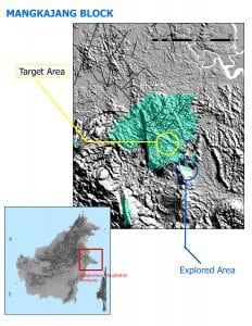
Mangkajang Block
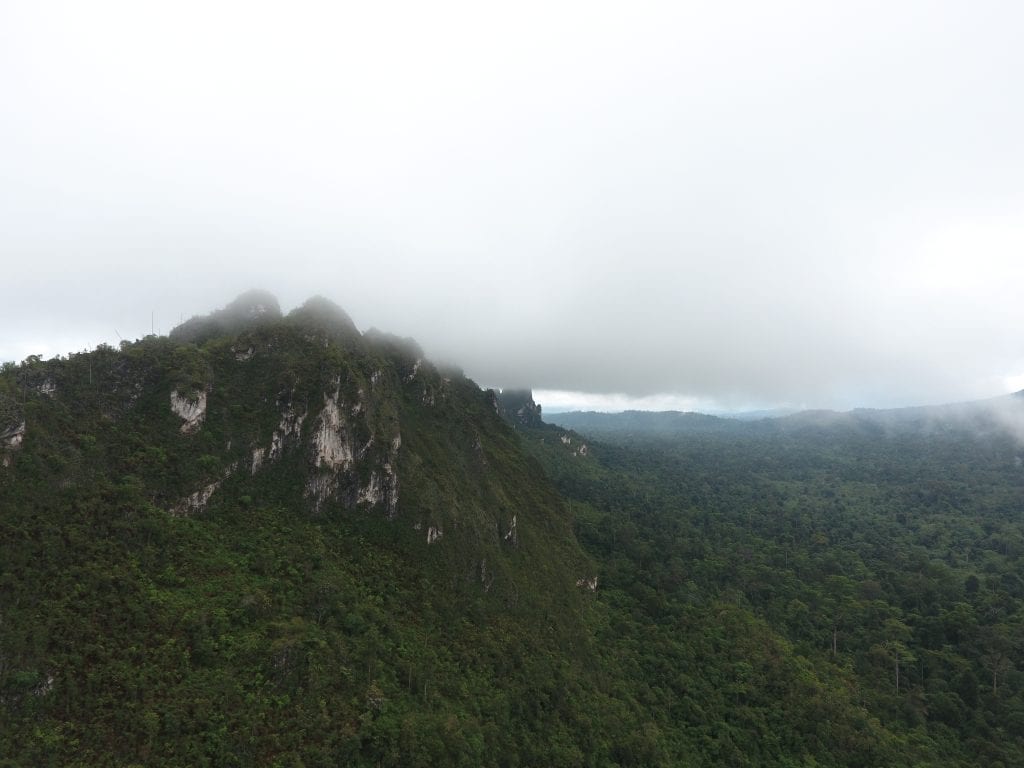
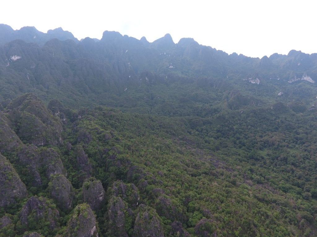
Mangkajang Block is a mountainous karst area with several isolated blocks and unique hydrology system. Mangkajang is located in the northest area of Sangkulirang-Mangkalihat Karst System and the nearest from Tanjung Redeb City, capital city of Berau Regency with the distance is only around 30 kilometers from it.
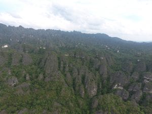
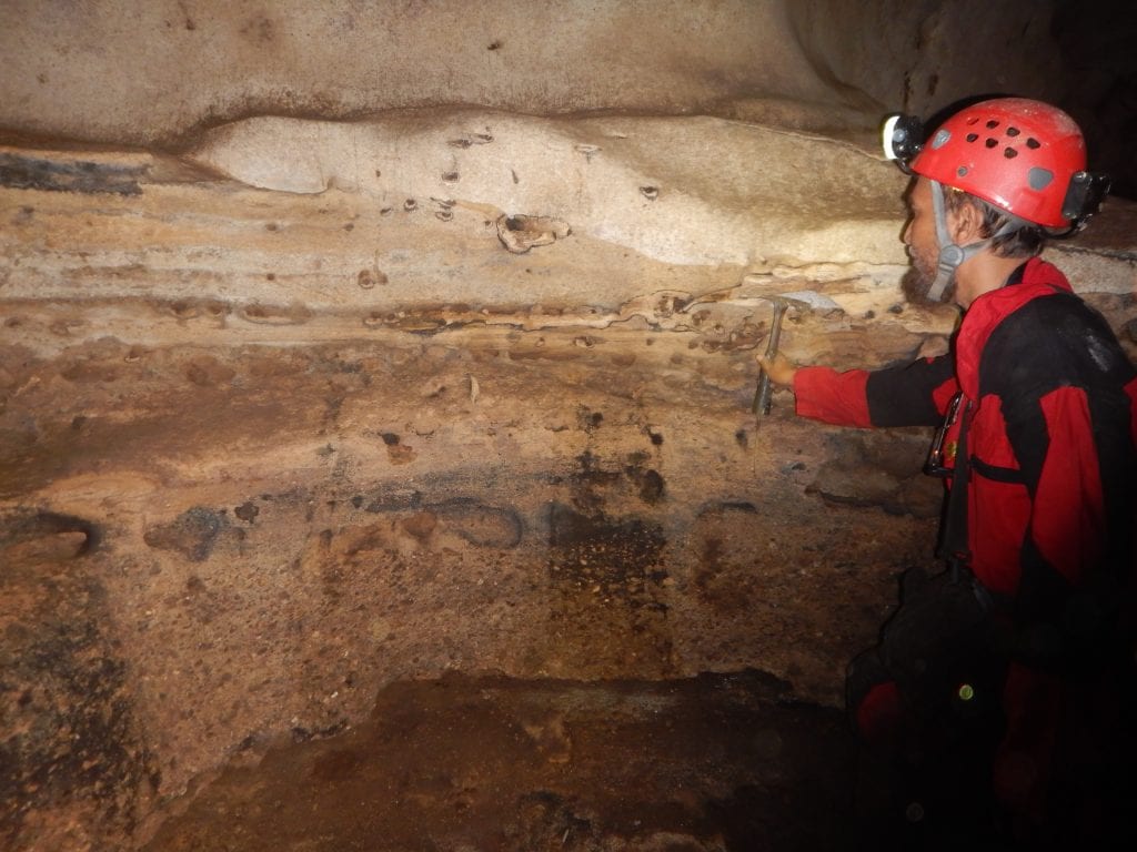
Mangkajang Block is comprised by Oligo-Miocene Lembak Limestone. Previous study has shown how strong erosion and geological structures play a significant role in shaping several isolated karst in the south area of it. Several caves were found on those isolated karst like Melawang Rock where more than 4 stories or layer of caves are stacked. Although several caves had been discovered and explored, previous expedition on 2016 by Universitas Gadjah Mada only touch the outer part of the block. The inner part is still untouched.
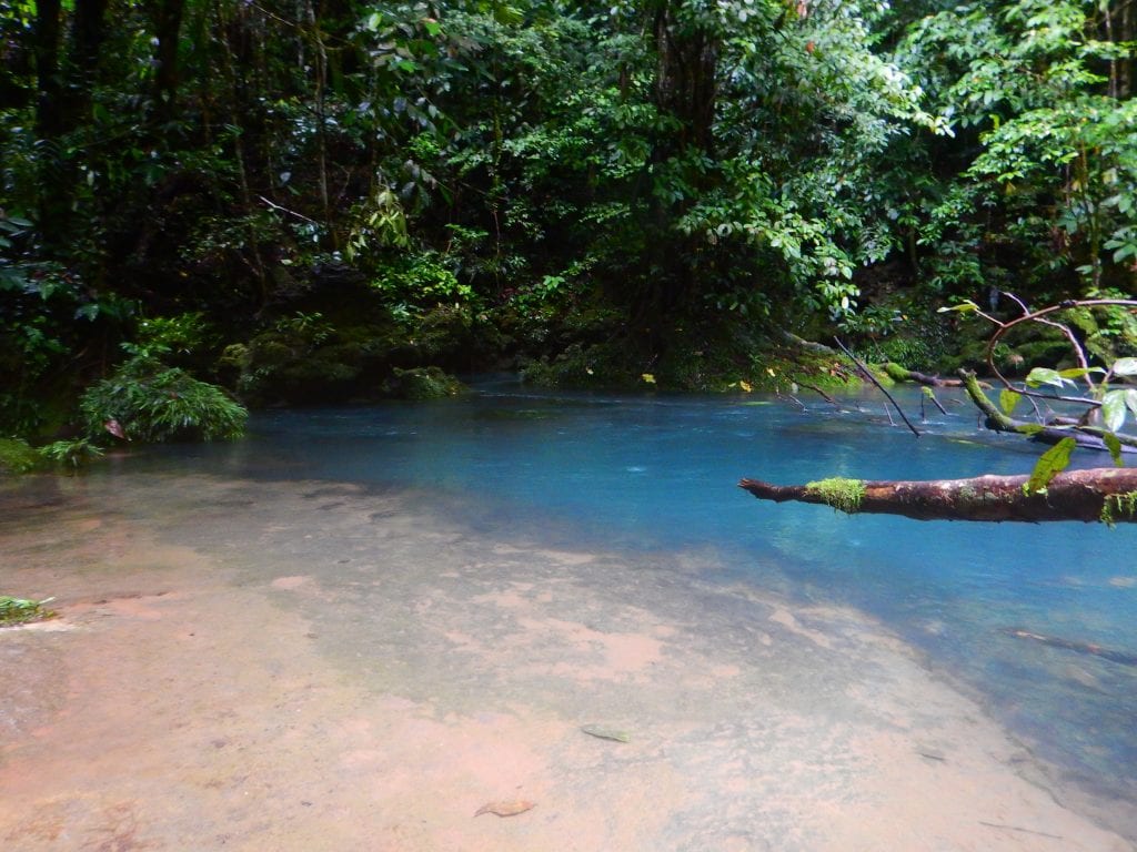
The hydrology setting of this block is probably the most fascinating aspect to study. Separated karst affects the stream of the river where in several spots there are sinkholes and resurgences with big underground river like Selung Cave, a huge underground river. Also, there is Danau Biru (Blue Lake), a big karst pond indicated as main source of water in the eastern Mangkajang.
Ease of access and friendly guides would become advantages to support our expedition in this area.
How to Get There?
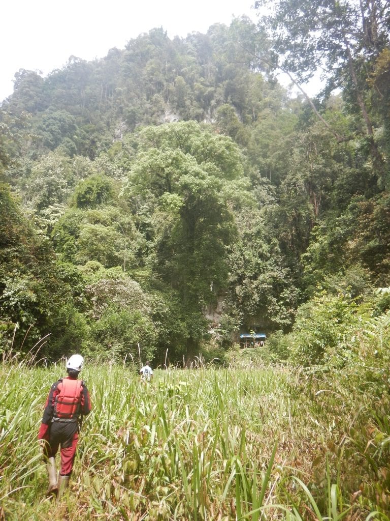
Nearest airport is Kalimarau Airport at Tanjung Redeb, Berau Regency. Afterward, we need to continue the trip using car for about 2 hours to Suaran Village, the nearest village to Mangkajang Block. From here, the adventure begins for about 1 days to Melawang Base Camp and we will go through dense lowland rainforest. We should take a night in Melawang Base Camp before proceed deeper for another day to Danau Biru. We plan to build flying camp at Danau Biru and start to explore from here.
Equipment
We shall focus more on hydrology hence, apart from SRT Set and Cave Mapping Tools, we need to bring water quality tester. We will provide camp appliances and diesel generator for our electric supply.
Specific Goals
In Mangkajang Block, we plan to explore the inner part of the area and plot and map all the caves in there. Also, we keen to study the hydrology pattern in this block to predict the water resource.
Download the Leaflet